Eastern Connecticut Forest Landowners / Wolf Den Land Trust
MAPS OF WOLF DEN LAND TRUST (WDLT) PROPERTIES
Maps of the following Wolf Den Land Trust properties are available online.
JUMP TO: Bicknell | Blue Flag | Brumback | Cloutier | Ferguson Williams | Gardner | Lehtimaki | Ostby | Sherman | Shoemaker | White Brook
WDLT Property Holdings in Fee Simple: 682.5 acres
WDLT Holds Conservation Easement (Preserved properties): 200 acres
- A number of these properties currently have a trail system, and are open to the public for passive recreation such as birding and day hiking. No motorized vehicles are allowed.
- Free Adobe Acrobat Reader is needed to open PDF files. Download Acrobat Reader.
- JPEG files should be viewable in any image viewing software.
- Also see spreadsheet listing properties
- Click on file for a full size (8 x 11) version, or on thumbnail for a larger image. Hit your "back" button to return to this page.
| BICKNELL 30 acres Westford Hill Rd Ashford |
The Mildred Bicknell Conservancy is a 30-acre property located on Westford Hill Road in Ashford, approximately one half mile northwest from the intersection of Westford Hill Road and Westford Road (Route 89). |
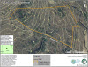 |
| BLUE FLAG 92.7 acres Trail Kenyon Rd Eastford Hampton |
Blue Flag Meadow is a 92.7- acre property located mostly in the town of Hampton and partly in the town of Eastford. The entry to the property is located on Kenyon Road in Hampton, approximately 2.2 miles northeast from the intersection of Pomfret Road (Route 97). Fee Simple WDLT holding. |
 |
| BRUMBACK 22 acres Eastford Rd, Eastford |
||
| CLOUTIER 102.9 acres Ballamahack Rd, Windham |
||
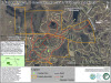
| FERGUSON WILLIAMS 152.6 acres Trail Herrick Rd Pomfret Rd Brooklyn |
The C. Vaughan Ferguson Jr. Conservancy, Lester B. Williams Memorial Forest, and Lester B Williams Memorial Forest addition are located in the town of Brooklyn. Together, these properties cover a total of 152.6 acres. Access points to these properties are located on Pomfret Road (Route 169) approximately 1.3 miles north from the intersection of Route 6, and on Herrick Road approximately one half mile west from the intersection of Pomfret Road. |
 |
| GARDNER 17 acres Ashford Center Rd Ashford |
Merritt Gardner Memorial Forest is a 17-acre property located on Ashford Center Road (Route 44) in the town of Ashford, approximately four tenths of a mile east from the intersection of Route 89. | 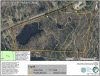 |
| LEHTIMAKI 13 acres Brooklyn |
|
|
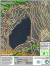
| OSTBY 83.5 acres East Old Rte 6 Hampton |
Ostby Memorial Forest is a 83.5-acre property located in the town of Hampton. The north side of the property borders Sarah Pearl Road, approximately three tenths of a mile from the intersection of North Bigelow Road. The south side of the property borders East Old Route 6, approximately one half mile west from the intersection of Providence Turnpike (Route 6). Also see Ostby property under a Conservation Easement. |
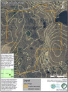 |
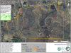
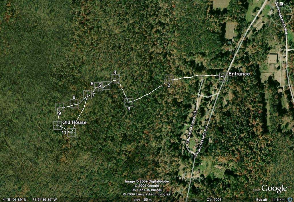
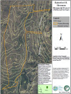
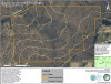
| SHERMAN 77.9 acres Trail Breakneck Hill Rd Killingly |
The Rainsford B. Sherman Memorial Forest is a 77.9-acre property located on Breakneck Hill Road in the town of Killingly. The south and north access points to this property are located respectively approximately six tenths of a mile and approximately eight tenths of a mile from the intersection of Hartford Pike (Route 101). The north access point has a parking area and a trailhead to a trail network within the property (not shown). The south access point is undeveloped. Rainsford B. Sherman - Green Trail. Entrance is the trailhead on Breakneck Hill Road in Killingly, CT. The trail from the entrance to the old house is about 2.4 miles long. The house is a well preserved foundation and chimney probably dating back to the 19th century. JPEG File. |
|
| SHOEMAKER 51.4 acres Brooklyn Pike, Scotland |
Shoemaker Demonstration Forest, The Shoemaker Demonstration Forest is a 51.4-acre property located on the Brooklyn Turnpike in the town of Scotland, approximately one half mile southwest from the intersection of Pudding Hill Road (Route 97). |
|
| WHITE BROOK 41 acres Trail Darby Rd Brooklyn |
White Brook (Townsend) Sanctuary is a 41- acre property located on Darby Road in the town of Brooklyn. The parking area on the northeast corner of the property as shown on this map is located approximately one half mile east from the intersection of Barrett Hill Road. |
 |
WDLT HOLDS CONSERVATION EASEMENT |
||
| DODGE Woodstock 35 acres |
||
| KOCH 50 acres Goodwin Rd Canterbury |
Frank C. Koch Memorial Forest | See article. |
| OSTBY 40 acres East Old Rte 6 Hampton |
Adjacent to Ostby property, not including residence | |
| RACY 110 acres Water St Canterbury |
Racy Property | |
All rights reserved. ©2019 Chimalis LLC
If you have comments about this website, including broken links,
please contact the webmaster